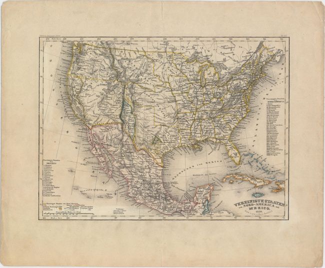
Subject: United States & Mexico, Texas
Period: 1850 (dated)
Publication: Meyer's Zeitungs Atlas
Color: Hand Color
Size:
10 x 7.5 inches
25.4 x 19.1 cm
Very attractive, highly detailed map with unusual configurations of the western territories of the United States. Texas is in its early "stovepipe" configuration with an elongated panhandle that extends northward, nearly to 40°. In Texas the French Franz Col. colony and the German Mainzer Verein colony are highlighted in text and separate hand coloring. A very large territory of Deseret encompasses most of the Southwest with many obsolete towns and settlements named. The boundaries closely coincide with those proposed in the provisional State of Deseret constitution prepared by the Mormon leadership in 1849, making it one of the most accurate contemporary maps of Deseret. A small California only extends south to Yerba Buena with Gold Region and Sutter's Fort named. New Mexico Territory is a small area squeezed between Texas and the Continental Divide and includes Santa Fe and Taos. The large Indian Territory encompasses today's Oklahoma, Kansas, and part of Nebraska. An uncommon map that is very finely engraved in the German style.
References:
Condition: B+
Minor soiling mostly in the blank margins with a soft, extraneous horizontal crease along the center of the map image.