Subject: Utah
Period: 1856 (dated)
Publication: Sen. Ex. Doc. No. 5, 34th Congress, 3rd Sess.
Color: Hand Color
Size:
15.7 x 32.7 inches
39.9 x 83.1 cm
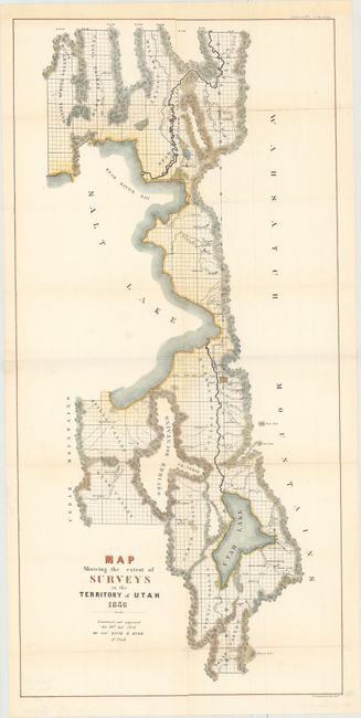
This early map by the General Land Office elaborates on the east side of the Great Salt Lake. Information includes early settlements such as Ogden, Provo, Bingham, Spanish Fork, Payson, Lehi and Farmington. There is good detail of watershed and topography. Tooele is here called Tuilla. The map extends north to include part of Bear Lake and south to below Mount Nebo. It is bounded east and west by the Wasatch and Cedar Mountains. Burr was a commercial cartographer and publisher of some note, in addition to being the Topographer to the Post Office and the Geographer to the House of Representatives. In 1855 President Pierce appointed Burr the Surveyor-General to the Territory of Utah following successful assignments as the Deputy Surveyor-General in Florida and Louisiana.
References:
Condition: B+
Issued folding, now pressed, and backed in tissue to repair a 4" tear in an unengraved area at right, several long fold separations, and numerous small holes along the folds, with minor loss of image. Remargined at top to accommodate framing.