Subject: Southeastern Texas
Period: 1852 (circa)
Publication:
Color:
The Office of Coast Survey is the oldest U.S. scientific organization, dating from 1807 when Congress directed that a "survey of the coast" be carried out. By 1836, it was called the U.S. Coast Survey and in 1878, the name was changed to the U.S. Coast and Geodetic Survey. Today the Office of Coast Survey is a division of the National Oceanic and Atmospheric Administration NOAA.
The survey teams, composed of civilians as well as Army and Naval officers, charted the nation's waterways and produced a wide array of reports, survey charts, hydrographic studies of tides and currents, astronomical studies and observations, and coastal pilots. These charts are an important record of the changing nature of the nation's coastlines. In additional to coastal charts, the U.S. Coast and Geodetic Survey produced land sketches, Civil War battle maps, and the early aeronautical charts.
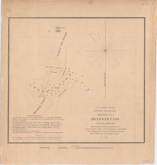
A. Sketch I No. 3 Aransas Pass Coast of Texas..., black & white (8.1 x 7.4"). This small map depicts the Aransas Pass between Mustang Island and San Jose Island (to the east of Corpus Christi). Shows numerous soundings and a proposed sight for a light boat.
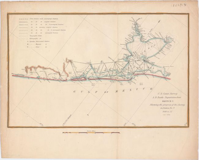
B. Sketch I Showing the Progress of the Survey in Section No. 9 , hand color (11.8 x 7.5"). This small but detailed chart shows the extent of surveying in the region. The map is roughly centered on Galveston and extends to include the West and East bays and north to San Jacinto.
References:
Condition: B+
Light toning.