Subject: Texas
Period: 1850-58 (circa)
Publication:
Color: Hand Color
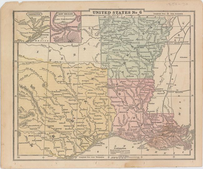
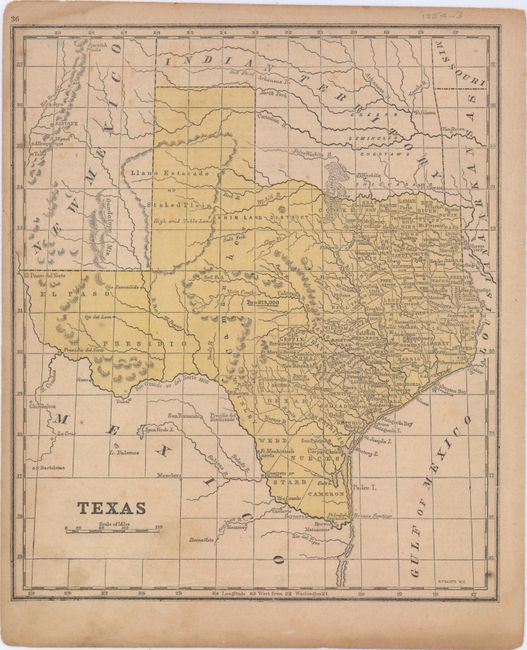
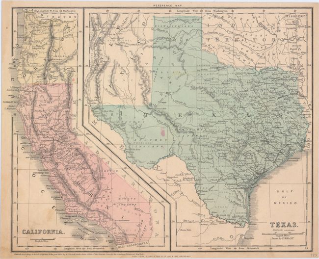
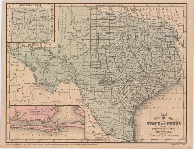
This lot of four school geography maps shows the evolution of the state over a short period of time. The progression reveals counties being added to the central and western portions of the state, as well as the expanding railroad infrastructure. The maps include:
A. United States No 6, circa 1850 (9.9 x 8.2"). Covers eastern Texas as well as Arkansas and Louisiana, with insets of Galveston and New Orleans. Condition: A few faint spots in the image and binding holes in the lower blank margin.
B. Texas, by S.F. Baker, circa 1854 (8.8 x 10.3"). Condition: Light soiling and toning with a few spots of foxing.
C. Texas, by E. Wells, dated 1856 (12.8 x 10.1"). Includes a smaller map of California at left. Condition: Minor soiling with an edge tear at bottom that extends 0.25" into the image.
D. No. 13 Map of the State of Texas, by Samuel Augustus Mitchell, from Mitchell's School and Family Geography, dated 1858 (10.6 x 8.2"). Includes insets of "Northern Texas" and "The Vicinity of Galveston City." Condition: A few minor spots in the image.
References:
Condition: B+
See description above.