Subject: Rhode Island
Period: 1822 (circa)
Publication: A Complete Historical, Chronological, and Geographical American Atlas...
Color: Hand Color
Size:
8.4 x 11.4 inches
21.3 x 29 cm
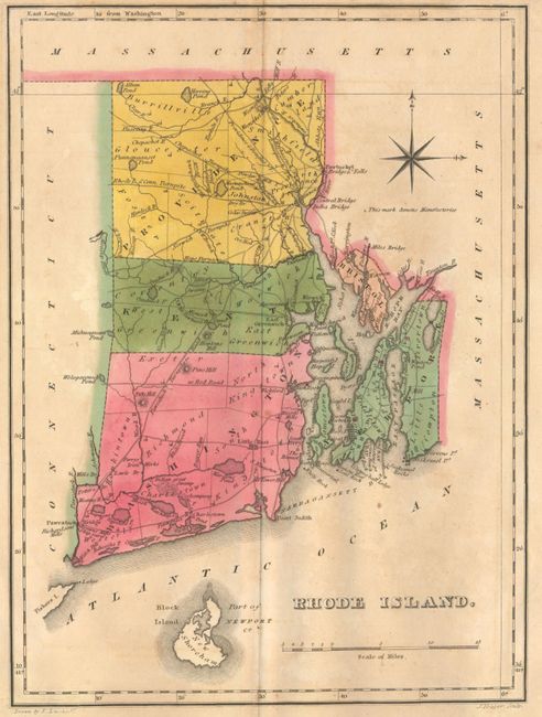
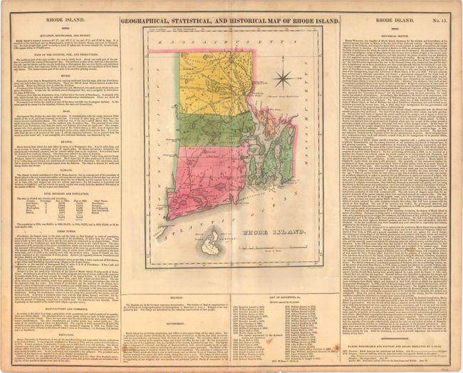
This map was drawn by Fielding Lucas and engraved by J. Yeager. It shows the state with a population of only 83,000 as compared to today's number of over one million. Five counties are named, and there is an adequate network of wagon roads. Newport, Little Rest, Bristol, Warren, and Providence are shown in a block layout. All of Block Island is shown to the south. Towns and settlements include Tower Hill, Charlestown, East Greenwich, and Pocasset. Among details are a powder mill, the Great Swamp, Perry's Iron Works, as well as turnpikes headed to Norwich, Connecticut, and Pawcatuck. On a full folio sheet (21.9x 17.6"), the surrounding text gives historical, physical, and political information. A table lists all Governors current to William C. Gibbs, 1821.
References: Phillips (Maps) p. 744.
Condition: B+
Original color with overall light toning and faint offsetting in the image. Minor soiling and short fold separations at top and bottom.