Subject: World
Period: 1755 (dated)
Publication:
Color: Hand Color
Size:
26.6 x 17.5 inches
67.6 x 44.5 cm
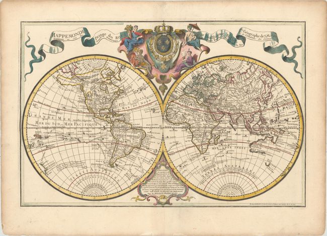
This impressive large double-hemisphere map is based on the work of Delisle, with the latest discoveries of the previous 30 years, as mentioned in the cartouche at bottom. The routes of numerous explorers are depicted, including Magellan (1520), Mendanna (1595), Quiras (1605), Le Maire (1615), Tasman (1642), St. Louis (1708), and Antoine (1710). The western portion of North America is still largely blank with the exception of a large Mer de l'Ouest. A broken coastline continues to the northwest with several notes of explorers' discoveries and a misshapen Alaska named Presqu'Isle du Nord Ouest. Australia and New Zealand are only partially mapped, and Australia extends north to New Guinea. Above the map is a decorative cartouche featuring the French coat of arms surrounded by allegorical figures representing the four continents. This is the first state and typically appeared in composite atlases by Buache.
References: McGuirk #44.
Condition: A
A crisp impression on sturdy, watermarked paper with wide margins and very minor soiling.