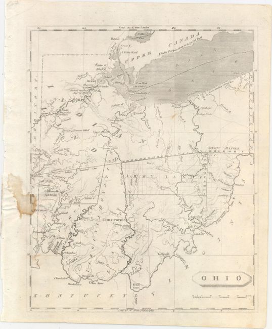
Subject: Ohio
Period: 1804 (published)
Publication: A New and Elegant General Atlas
Color: Black & White
Size:
7.9 x 9.8 inches
20.1 x 24.9 cm
This important early map of Ohio depicts the large land divisions made by Congress shortly after gaining statehood. The state is divided into Indian Lands, Army Lands, Seven Ranges, Virginia Donation Lands, and a French grant. Numerous forts, settlements, battlefields, rivers, portages, and early roads are depicted throughout. The notation Major Truman killed appears in the northwest, depicting the location where Captain Alexander Trueman was killed by Indians while on a peace mission in 1792.
References: Phillips (Maps) p. 627.
Condition: B+
An uneven impression at left with a small stain entering the left border. Remnants of paper tape in top margin on verso.