Subject: Albany, New York
Period: 1828 (dated)
Publication:
Color: Black & White
Size:
15.5 x 12.1 inches
39.4 x 30.7 cm
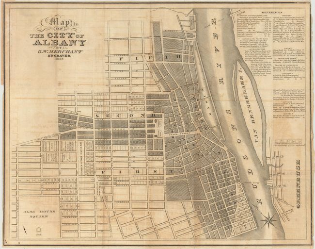
This plat map of the city was published just three years after the completion of the Erie Canal, and the eastern terminus (lock one) is visible to the north of Colonie St, along with the "Canal" above it. The completion of the Erie Canal made Albany a transportation hub for emigrants heading to western New York and Michigan Territory. The map itself presents the city's growing street grid and identifies lots, buildings, parks, squares, and the Great Western Turnpike. An extensive list of references identifies churches, offices, banks, libraries and "places of amusement." Only two copies are located on OCLC and we have found only one dealer listing in the last 30 years.
References:
Condition: B
Issued folding with light offsetting. No edge tears or fold separations. Narrow margins with several small chips confined to blank margins.