Subject: New York
Period: 1801 (dated)
Publication:
Color: Black & White
Size:
16.5 x 14.6 inches
41.9 x 37.1 cm
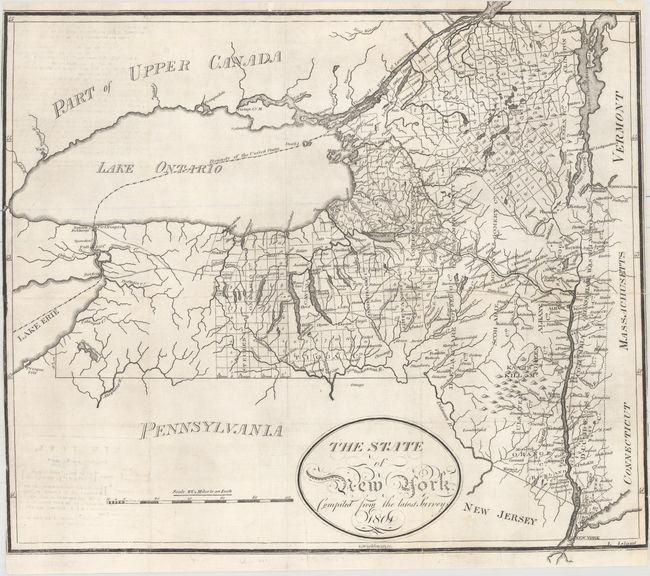
This uncommon map of the state is filled with place names. It shows the extent of the surveys in the northern part of the state as well as its developing western frontier. Little detail appears west of Steuben County. The map depicts the State Road, which connected Albany to Lake Erie before the development of the Erie Canal. There is nice detail of the state's rivers and lakes, and the Catskills (Kaats Kill) are located. The United States-Canada border is delineated in Lake Ontario. Portions of surrounding states and Canada are largely unengraved.
References:
Condition: B+
A crisp impression issued folding, now flattened, with professional repairs to several small tears and a 3" tear at top left. There is minor offsetting at left from an opposing page of text and a single worm hole in Steuben County. The margins have been trimmed to the neatline at left and right.