Subject: Montana
Period: 1887 (dated)
Publication: Sen. Doc. 58, 52nd Congress, 1st Session
Color: Printed Color
Size:
39 x 26 inches
99.1 x 66 cm
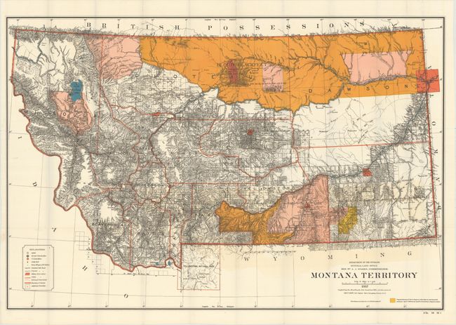
This is the uncommon large edition map that shows in great detail the extent of public surveys in Montana just two years before attaining statehood in 1889. Hydrology and topography are well developed on this colorful map. The map shows Indian reservations (Blackfeet, Flathead etc.), military posts (Forts - Assiniboine, Keogh, Maginnis, Custer, Camp Baker, etc.) and the completed and proposed railroads. Also locates Custer Hill, Custer's Monument, and the Reno battlefield; and Yellowstone National Park in its entirety with major features identified. Remarkable detail throughout on a scale of 1 inch to 15 miles. Extensive legend identifies land offices, Surveyor Generals Office, county seats, towns, villages and railroad stations, railroads (completed and proposed), military reservations, Indian reservations, railroad land grant limits, etc.
References:
Condition: A
A clean, bright example with a little faint color offsetting above the title. Issued folding.