Subject: Montana
Period: 1879 (dated)
Publication: Sen. Ex. Doc. 120, 46th Congress
Color: Black & White
Size:
21 x 15 inches
53.3 x 38.1 cm
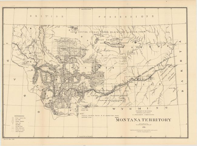
Uncommon map of territorial Montana showing the amended and proposed routes of the Northern Pacific Railroad as well as Indian reservations and dates of treaties. The map is filled with topographical detail, and includes excellent information on the extent of surveying and settlement with many towns named. The site of the Battle of Little Bighorn (1876) is located by the presence of Fort Custer at the confluence of the Big Horn and Custer Rivers. Yellowstone National Park was created in 1872, and the northern border is shown on the bottom of the map. Montana was admitted into the Union in 1889.
References:
Condition: A
A clean example, issued folding, with one tiny edge tear in the left blank margin closed on verso with archival tape.