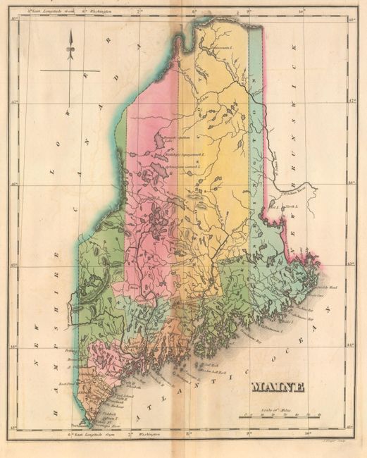
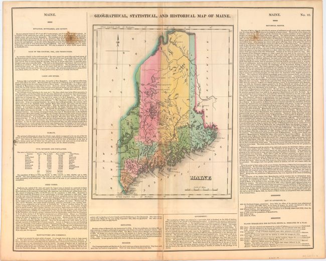
Subject: Maine
Period: 1822 (circa)
Publication: A Complete Historical, Chronological, and Geographical American Atlas...
Color: Hand Color
Size:
9.6 x 11.9 inches
24.4 x 30.2 cm
This map of the new state of Maine was beautifully engraved by J. Yeager. It shows the state with only nine counties and a population of less than 300,000. There is good detail of the extensive system of lakes and rivers. Wagon roads are limited to the southern portion, most connecting coastal towns. Bangor and Canaan, as well as many small villages are named. A handsome map on a full folio sheet (22.3 x 17.8") with surrounding text giving historical, physical, and political information. A table lists all governors current to Albion K. Parris, 1821; from 1652 to 1820, Maine was under the jurisdiction of Massachusetts.
References: Phillips (Maps) p. 384.
Condition: B
Original color with toning along the centerfold, two small stains in the text panels at left and right, and a centerfold separation that extends into the descriptive text at bottom closed on verso with archival material.