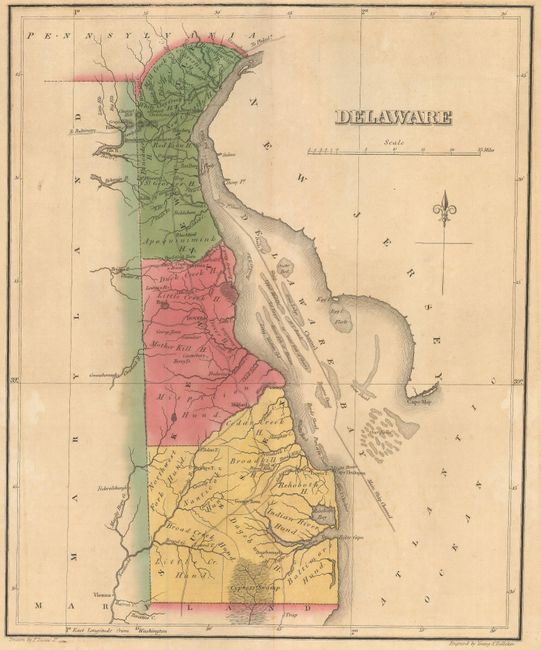
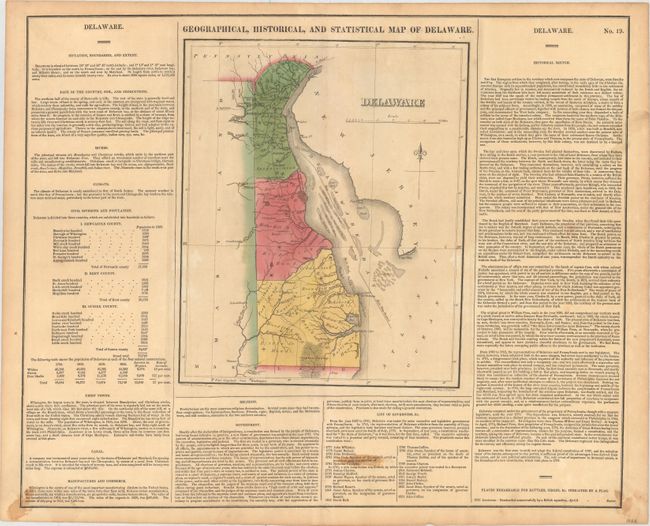
Subject: Delaware
Period: 1822 (circa)
Publication: A Complete Historical, Chronological, and Geographical American Atlas...
Color: Hand Color
Size:
9.6 x 11.7 inches
24.4 x 29.7 cm
This map was drawn by Fielding Lucas and engraved by the firm of Young & Delleker. It shows the state with a population of less than 73,000 including 4,500 slaves and 13,000 "Free Blacks." In Delaware Bay numerous shoals with the "Main Ship Channel" are depicted winding its way through the hazards. There is a modest network of wagon roads with towns and settlements including George Town, Louisville, Dover and Wilmington. The map is on a full folio sheet (22.0 x 17.6") surrounded by English text giving a brief description of the state’s boundaries, rivers, climate, chief towns, government and history.
References: Phillips (Maps) p. 260.
Condition: B+
Original color with light toning and a few small stains in the descriptive text. Additional text "until the election of" has been adhered to the sheet within the list of governors -- apparently a correction made by the publisher.