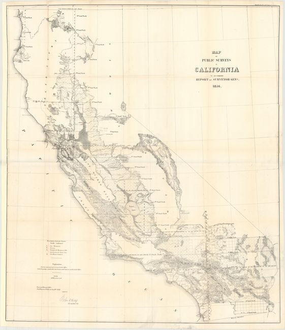
Subject: California
Period: 1856 (dated)
Publication:
Color: Black & White
Size:
31.4 x 36.2 inches
79.8 x 91.9 cm
This large and remarkably detailed map delineates the progress of public surveys throughout the state on the scale of 18 miles per inch. About one-third of the state, in the north and east, remains unsurveyed. Topography is by hachure. The map shows in high clarity the watershed, railroads, towns and villages, springs, missions, forts, etc. Lake Tahoe is shown fairly accurately, but is still called Bigler Lake. Signed in the plate by John C. Hays, U.S. Surveyor General of California. Printed on two sheets, joined as issued.
References:
Condition: B+
Issued folding and now professionally backed in tissue to repair a few short fold separations. A clean and bright example with just a hint of foxing and toning along the folds. A portion of the border at left and right was trimmed and then professionally reattached. Remargined at left to accommodate framing. There is a slight bluish line along the joint that is caused by our scanner and does not appear on the map.