Catalog Archive
Auction 154, Lot 184

"Johnson's California, with Territories of Utah, Nevada, Colorado, New Mexico, and Arizona", Johnson & Ward

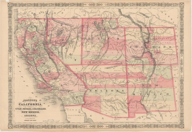
Subject: Southwestern United States

Period: 1864 (dated)

Publication: Illustrated Family Atlas

Color: Hand Color

Size:
23.5 x 16.9 inches
59.7 x 42.9 cm
Download High Resolution Image
(or just click on image to launch the Zoom viewer)

This is the late 1863 - early 1864 edition in this series of maps. Arizona still has the county configurations of the old New Mexico Territory, with the addition of Castle Dome and Ewell counties in the south. The Utah/Nevada border is now at 115°. This is a completely new plate with many changes in watershed and mountain detail with several of the earlier notations removed. Details the U.S. Mail routes, the Emigrant roads to California, the proposed railroad route through Utah, Nevada and California, and the Pony Express trail.

References:

Condition: B+

Original color with light toning. There are a number of short tears along the edges of the sheet that have been closed on verso, some with archival material and some with cello tape.

Estimate: $200 - $230

Sold for: $150

Closed on 9/16/2015

Archived