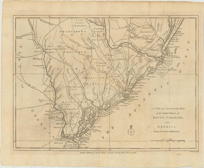
Subject: Colonial Southeast United States
Period: 1780 (published)
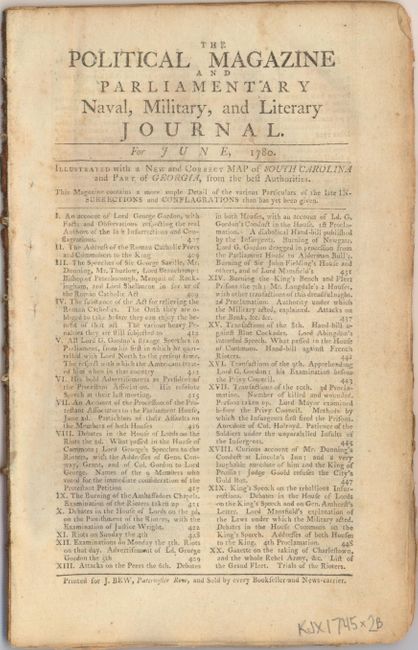
Publication: Political Magazine
Color: Black & White
Size:
14.8 x 10.8 inches
37.6 x 27.4 cm
Uncommon Revolutionary War map of the region in South Carolina and Georgia from about the Savannah River to the Wackamaw River. The map was created to depict important battle sites and British victories during the Southern Theater of the war, including the capture of Savannah, Georgia in December 1778 and Charleston, South Carolina in May 1780. The map is filled with detailed information of the roads, forts, towns, townships, precincts and parishes. Published by John Bew.
The map is accompanied by (not bound in) the complete June 1780 issue of The Political Magazine which includes an account of the "Taking of Charleston and the Whole Rebel Army."
References: Jolly #POL-7.
Condition: B+
Issued folding with light offsetting and a few extraneous creases at right where the map was folded into the magazine.