Subject: Mid-Atlantic United States
Period: 1799 (circa)
Publication: Atlas Moderne Portatif
Color: Hand Color
Size:
8.6 x 6.9 inches
21.8 x 17.5 cm
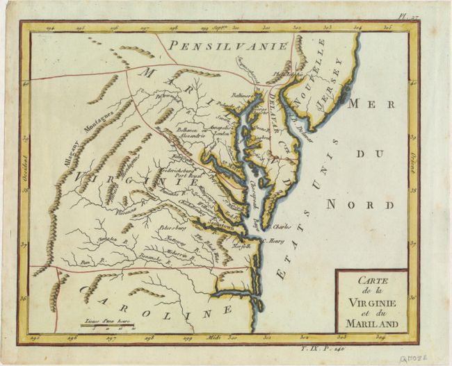
This unusual map of the Mid-Atlantic region exhibits some very odd boundaries. Maryland is an ill-defined wedge between Virginia and Pennsylvania and does not extend beyond the Allagany Montagnes. Maryland's most prominent settlement is St. Marie, the colony's first capital. Delaware is named Delavar Cte. and Alexandria is also called Belhaven. Many interesting areas are located including the Tabaco Mtns, Jamestown, and Annapolis. This map is similar to Joseph de Laporte's 1780 map of the same title with a simpler cartouche and a change in the Atlantic Ocean from Possessions Angloises to Etats Unis, reflecting the French support for American independence.
References:
Condition: A
A nice impression on watermarked paper with faint foxing.