Subject: Colonial Mid-Atlantic United States
Period: 1780 (dated)
Publication: Political Magazine
Color: Black & White
Size:
14.8 x 10.8 inches
37.6 x 27.4 cm
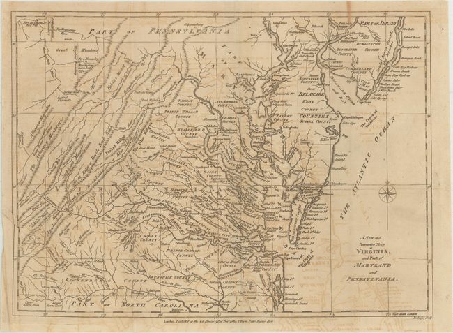
This scarce map of the Mid-Atlantic, published during the American Revolution, covers the region from the Chesapeake Bay north to Philadelphia and west to the Appalachian mountains. The map locates George Washington’s Mount Vernon along the Potomac River and magazine text (not included) indicates “In the map we have point out Mount Vernon, the rebel commander’s house. It is finely situated on a very high hill on the banks of the Patowmac.” With a clear British point of view, the map also locates Fort Necessity in present-day Southwestern Pennsylvania, where “Washington [was] taken here” in 1754 during the French and Indian War. This proved to be Washington’s only defeat. Published by J. Bew in London.
References: Jolly #POL-17.
Condition: B
Issued folding on watermarked paper with light to moderate offsetting and several extraneous creases.