Catalog Archive
Auction 154, Lot 143

"A New and Accurate Map of Virginia & Maryland Laid Down from Surveys and Regulated by Astronl Observatns", Bowen, Emanuel

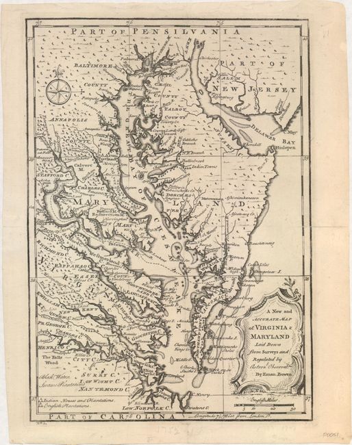
Subject: Colonial Mid-Atlantic

Period: 1747 (circa)

Publication: A Complete System of Geography

Color: Black & White

Size:
9.1 x 12.9 inches
23.1 x 32.8 cm
Download High Resolution Image
(or just click on image to launch the Zoom viewer)

This uncommon map centered of the Chesapeake Bay region is based on Augustine Hermann's map of 1673 and Henry Popple's great map of 1733. Filled with detail, numerous early towns and villages are located. A symbol key graphically depicts Indian Houses and Plantations, and English Plantations. It is decorated with a title cartouche and compass rose. This is the third state, with plate No 61 below neatline at left.

References: McCorkle (18th C. Geography Books) #17, Vol. II [30].

Condition: A

A clean and crisp example with a professionally repaired centerfold separation that just enters map image at right. An extraneous vertical crease has been pressed flat and is nearly invisible.

Estimate: $800 - $950

Sold for: $600

Closed on 9/16/2015

Archived