Subject: New England - United States
Period: 1824 (dated)
Publication:
Color: Hand Color
Size:
36.3 x 28.7 inches
92.2 x 72.9 cm
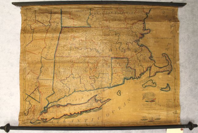
This rare and detailed wall map covers the region from eastern New York to Cape Cod and from southern Vermont and New Hampshire to Long Island. Delineated by county, the map shows basic information including towns, villages, roads, and bridges, as well as a few more unusual categories including waterfalls, lighthouses and "Humane Society houses." Identifies the location of General Burgoyne’s surrender in Saratoga County as well as the newly established military academy at West Point. The title cartouche is surrounded by the Great Seal of the United States at top and the seals of Connecticut, Massachusetts and Rhode Island at bottom.
Edward Ruggles was a relatively unknown cartographer, having published a few maps of the New England region, and was one of only a handful of cartographers operating out of Vermont in the early 19th century. Engraved by M.M. Peabody and published by E. Hutchinson in Hartford, VT. Still attached to original wooden rollers.
References:
Condition: C+
Original color with heavy toning, light soiling, cracking due to the varnish, and a 1.5 x 0.5" chip along the top left border. Several other small chips are mostly confined to the blank margins. Original rollers are good with a few tiny chips and abrasions.