Catalog Archive
Auction 154, Lot 133

"An Accurate Map of Rhode Island, Part of Connecticut and Massachusets, Shewing Admiral Arbuthnot's Station in Blocking up Admiral Ternay", Lodge, John

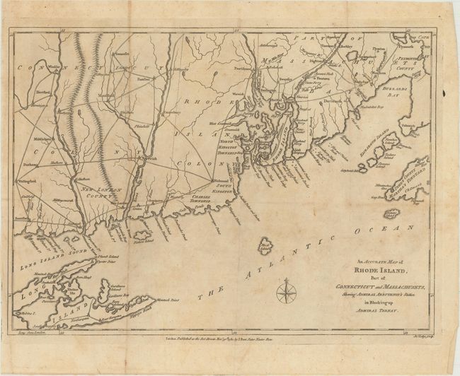
Subject: Colonial New England

Period: 1780 (dated)

Publication: Political Magazine

Color: Black & White

Size:
14.8 x 10.5 inches
37.6 x 26.7 cm
Download High Resolution Image
(or just click on image to launch the Zoom viewer)

An uncommon, Revolutionary War era map shows the coastline from Woods Hole and Buzzard's Bay down to Long Island, including Montauk Point and the Hamptons. The title describes a naval skirmish that took place between the revolutionary forces of France's Admiral de Ternay and those of Britain's Admiral Arbuthnot, which ended in failure for the British forces. Published by J. Bew in London.

References: Jolly #POL-15; McCorkle #780.8.

Condition: B+

Issued folding on watermarked paper with light offsetting and a few extraneous creases from where the map was folded into the magazine.

Estimate: $350 - $450

Sold for: $200

Closed on 9/16/2015

Archived