Subject: Eastern United States
Period: 1850 (dated)
Publication:
Color: Hand Color
Size:
24.5 x 20.1 inches
62.2 x 51.1 cm
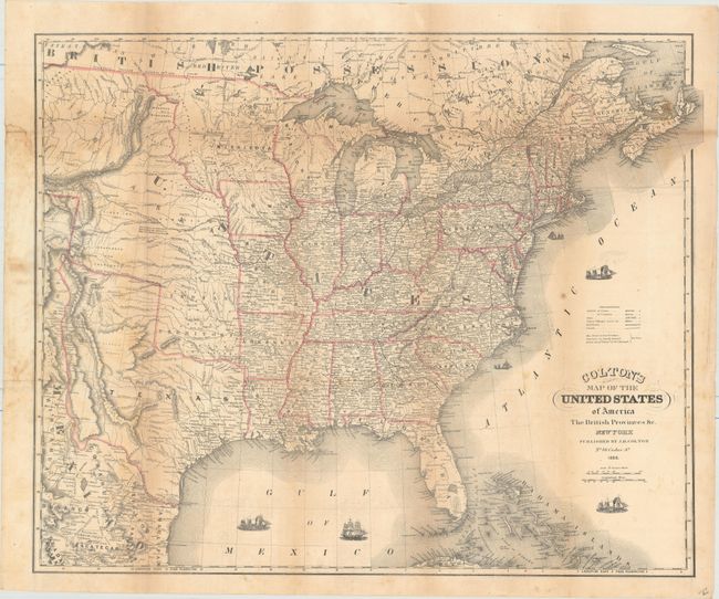
This folding map provides a detailed view of the eastern United States stretching west to the Rocky Mountains. Texas is shown in its stovepipe configuration (the colorist did not follow the engraved line to the top as called for), just prior to the Compromise of 1850. A huge Nebraska Territory occupies the region from the Missouri River to the Rockies, and a large Minnesota Territory encompasses the region from the Missouri east to the Mississippi. General Kearney’s Route, General Wool’s Route and the Santa Fe Trail are all depicted. The map is filled with place names, roads, railroads and rivers and is decorated by several boats in the ocean.
References:
Condition: B
Issued folding with light toning along the folds, several small stains, and a few tiny splits at fold intersections. There is a damp stain in the left blank margin, and one short edge tear also confined to the left blank margin has been closed on verso with archival tape.