Subject: United States, Civil War, Flags
Period: 1891-95 (published)
Publication: Atlas to Accompany the Official Records of the Union and Confederate Armies...
Color: Printed Color
Size:
27.8 x 16.6 inches
70.6 x 42.2 cm
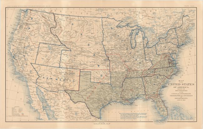
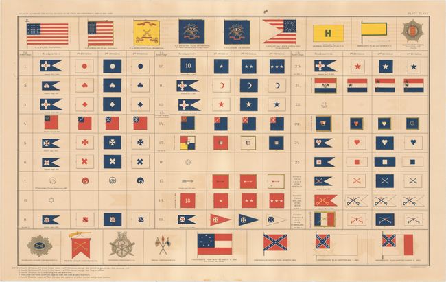
This lot of interesting Civil War sheets comes from the government's comprehensive atlas covering the War Between the States. These plates were issued between 1891 and 1895 to accompany the Official Army Records and were published under the Secretaries of War Redfield Proctor, Stephen B. Elkins, and Daniel S. Lamont by Maj. Gen. George B. Davis, assisted by civilian experts Leslie Perry and Joseph Kirkley. The first sheet comes from a series of ten maps tracking changes in boundaries, the position of troops, and the status of Confederate states in six month intervals throughout the course of the war. This is the sheet depicting the nation as it was on June 30, 1862. Changes from the previous map in the series, dated December 31st, 1861, include specifically naming Southwestern Virginia and East Tennessee, labeling a large swath of the Midwest as simply Mississippi, and noting the activities of various armies in Virginia at bottom. The second sheet shows a number of flags, including the nation's flag, the changing Confederate flag, the battle flags for various cavalries, and more. Size varies slightly.
References:
Condition: B+
The map of the United States has light toning while the flag sheet has occasional light color offsetting.