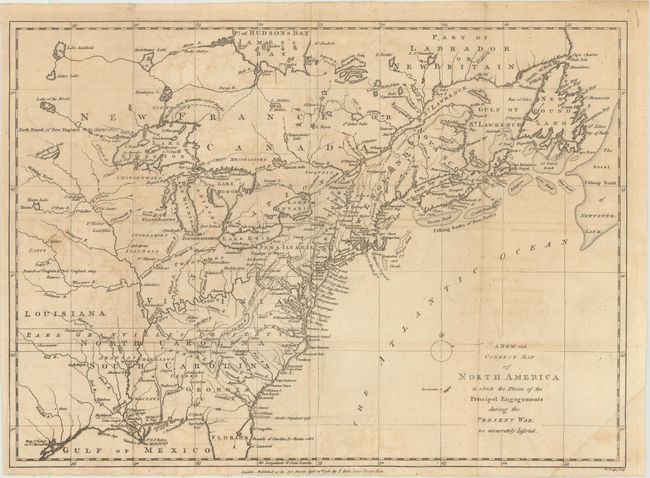
Subject: Colonial Eastern United States & Canada
Period: 1780 (dated)
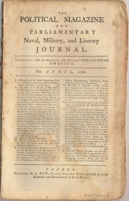
Publication: Political Magazine
Color: Black & White
Size:
15.1 x 10.9 inches
38.4 x 27.7 cm
According to Jolly, this is an early state of the map which shows the British view of their colonies during the American Revolution. Based on the cartography of Thomas Jefferys, the map covers from James Bay to the Gulf of Mexico and provides many details about the frontier wilderness, including numerous early forts, Indian villages and tribal territories. The mythical islands in Lake Superior are a hold-over from earlier French cartographers. Earl Granville's Property in North Carolina is shown extending beyond the Mississippi River. Published by J. Bew.
The map is accompanied by the April 1780 edition of Political Magazine which includes a six-page article describing the map and status of the war.
References: Jolly #POL-5; Phillips (Maps) p. 590.
Condition: B+
Issued folding with light offsetting and toning, a couple of extraneous creases, and a few short fold separations closed on verso with archival tape. The text has light soiling and toning, and a damp stain at bottom left.