Subject: Canada
Period: 1825-34 (circa)
Publication:
Color:
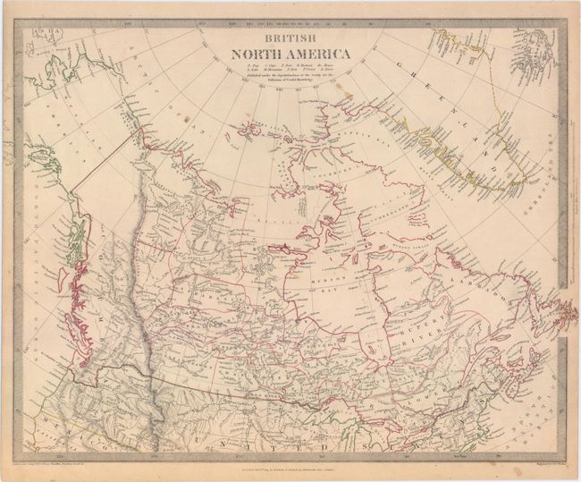
A. British North America, by Society for the Diffusion of Useful Knowledge (SDUK), dated 1834, hand color (16.3 x 12.4"). Steel engraved map that covers all of present-day Canada and the northern portion of the United States. In the Pacific Northwest, the border extends well into the United States reflecting British claims in the region. Alaska is Russian America. The Canadian Arctic region is largely unmapped and much of the interior is shown with limited detail, attesting to the knowledge of the day. Engraved by J. & C. Walker and published by Baldwin & Cradock. Condition: Pleasant light toning with a few small stains in the image.
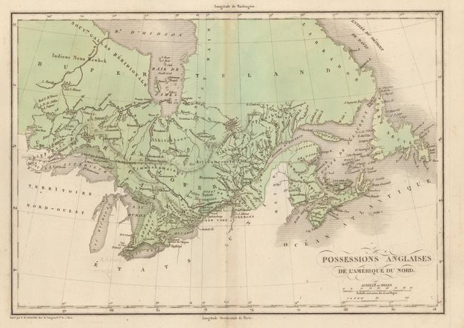
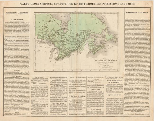
B. Carte Geographique, Statistique et Historique des Possessions Anglaises, by Jean Alexandre Buchon, circa 1825, hand color (14.0 x 9.8"). This is the French edition of Carey & Lea's atlas. The map covers the eastern portion of present-day Canada depicting Upper and Lower Canada with Rupert's Land to the north. Surrounded by panels of text describing the region. On a full sheet with text measuring 19.9 x 25.3". Condition: There are two small tears approximately 1" long in the image that have been closed on verso with archival tape, and two small edge tears that enter the text panels at left and right also closed on verso with archival tape. Faint toning along the centerfold and minor soiling mostly in the blank margins.
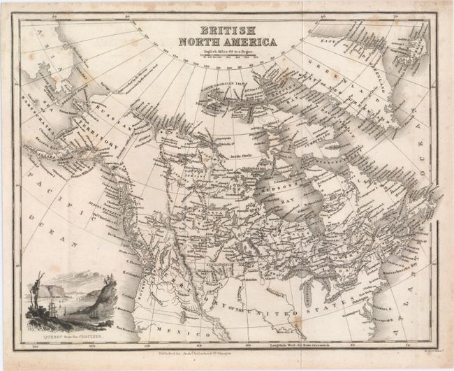
C. British North America, by Archibald Fullarton & Co., circa 1834, black & white (10.0 x 7.9"). This small map of Canada is densely filled with information including towns, cities, Indian tribes, rivers and topography. Notes "boundary settled 1825" with Russian Territory (Alaska). Despite the map being published in Scotland, the United States' border extends well into present-day British Columbia, reflecting U.S. interests in the region. Decorated by a small vignette of "Quebec from the Chaudier." Condition: A dark impression, issued folding with light scattered foxing.
References: Phillips (Maps) p. 601.
Condition: B+
See description above.