Subject: Exploration & Surveys
Period: 1862 (published)
Publication:
Color: Hand Color
Size:
5.8 x 9.1 inches
14.7 x 23.1 cm
During the 1850s, the U.S. government sponsored an extensive series of expeditions designed to gather information on the vast new territories that had been acquired in western North America. The discovery of gold in California further stimulated westward traffic and heightened the need for a faster and more convenient way to bring the far-flung parts of the country together. In 1853 Congress commissioned the Army's Topographic Bureau to conduct a series of surveys to find a suitable route for a transcontinental railroad. There were six major expeditions; five of them covered the area between the Great Plains and west coast, and the sixth explored the coastal states of California and Oregon. All of these expeditions were accompanied by naturalists and artists to document the landscape, flora and fauna along the route.
The reports, maps and lithographs were published in the 13 volume report "Explorations and Surveys to ascertain the most practicable and economical route for a Railroad from the Mississippi river to the Pacific Ocean."
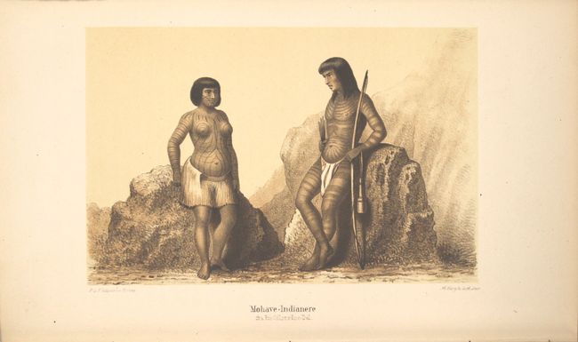
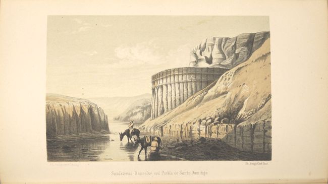
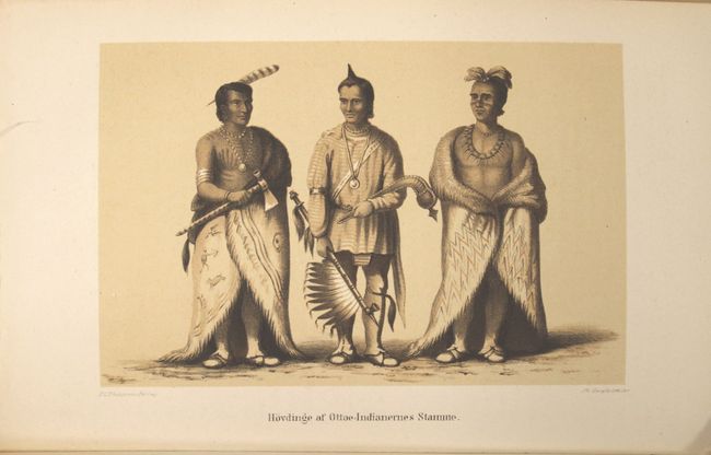
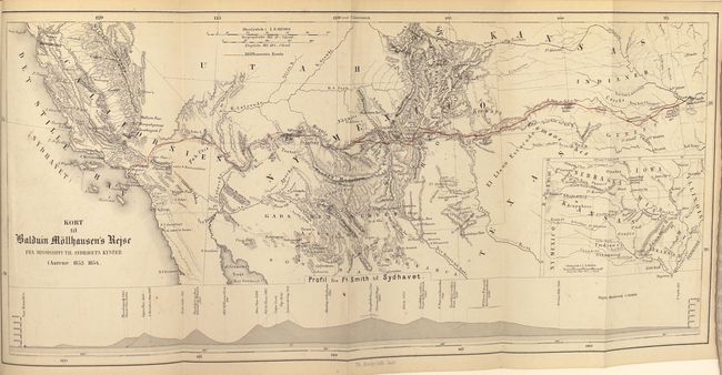
This is the Danish translation of Mollhausen's narrative while accompanying the 1853 Pacific Railroad Survey expedition led by Lieutenant Whipple. Howes states it was the "best account" and Wheat describes it as being superior to the official government report. Mollhausen served as the artist for the expedition, and has included 9 tinted chromolithographic plates depicting Native Americans and scenes along the expedition route. Included at the end of the text is a map that shows the expedition's journey from Ft. Smith to San Pedro entitled "Kort til Baldwin Mollhausen's Rejse fra Mississippi til Sydhavets Kyster..." (17.3 x 8.2"). 446 pp., hardbound in maroon cloth covered boards with gilt title on spine.
References: Howes #M713; cf. Wagner-Camp #305:1; cf. Wheat (TMW) #955.
Condition: A
Plates and text are clean, bright and near fine. One plate has light offsetting from the opposing page of text. The map has a few faint spots in the image and light toning along sheet edges. The spine is sunned and the edges are bumped.