Subject: Western Hemisphere - America
Period: 1857-62 (circa)
Publication:
Color: Hand Color
This lot of informative and intricately engraved German maps of the Western Hemisphere were published by the Weimar Geographisches Institut.
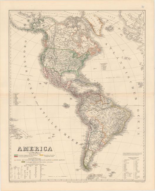
A. America, dated 1857 (20.0 x 25.3"). This map depicts the Western Hemisphere in its entirety, with part of Europe appearing at top right. The map is color coded to show the colonial possessions. There are keys to identify provinces in Mexico, mountains in South America, the smaller states in the U.S., and translations into Spanish, Portuguese, and English of various geographical terms. Drawn and compiled by Heinrich C. Kiepert and engraved by C. Jungmann.
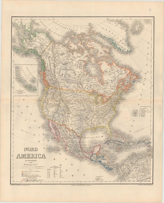
B. Nord America mit Westindien, dated 1859 (20.0 x 23.5"). This map focuses on North America. Color coding delineates between the different nations and European possessions on the continent. An inset at left details the Aleutian Islands. Keys present mountain names in Mexico, the names of the smaller states in the U.S., and translations of English and Spanish geographical terms. Drawn and compiled by Heinrich C. Kiepert and engraved by Wibel and C. Poppey Jr.
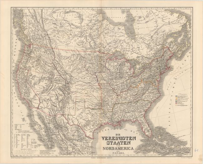
C. Die Vereinigten Staaten von Nordamerica nebst Canada, dated 1858 (25.3 x 20.8"). This map details the pre-Civil War United States and the southern part of Canada. Towns and cities, canals, main roads, and railroads both under construction and completed are located, and there is fine topographical detail. Outline color groups the states and territories into regions. West of the Mississippi are a number of territories, including Indian Territory, Minnesota, Nebraska, Kansas, Oregon, Washington, Utah, and New Mexico. A key provides English and Spanish translations of German geographical terms. Drawn and compiled by Heinrich C. Kiepert and engraved by C. Poppey Jr.
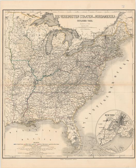
D. Die Vereinigten Staaten von Nordamerika (Ostlicher Theil), circa 1862 (22.2 x 25.0"). This map covers the eastern part of the United States, extending far enough west to show portions of Indian and Dacotah territories. Regions, towns and cities, railroads, rivers, and rapids are identified. A circular inset at bottom right concentrates on New York City and its immediate surroundings. Keys at bottom left explain the color-coded regions and various abbreviations used. Drawn by Th. Luther and engraved by C. Poppey Jr.
References:
Condition: B+
All are fine impressions with original color, minor toning along the centerfolds, and occasional faint offsetting. Both the first and the last sheet have short centerfold separations in their blank margins. The right margin on the last sheet is trimmed close to neatline.