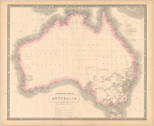
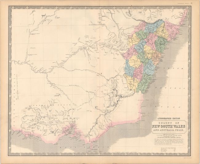
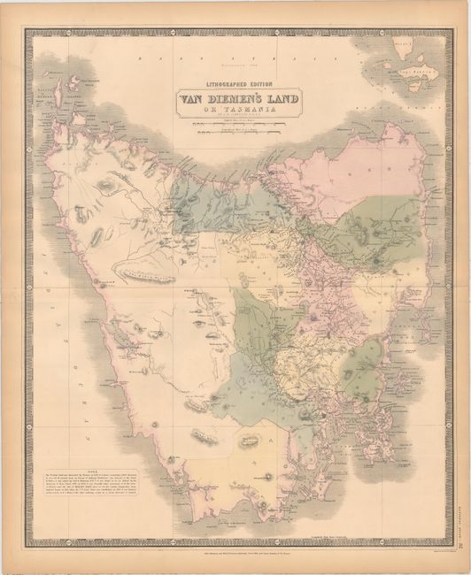
Subject: Australia
Period: 1849 (circa)
Publication: National Atlas
Color: Hand Color
Size:
23.6 x 19.5 inches
59.9 x 49.5 cm
Lot of three maps covering the Commonwealth of Australia. The first map shows the continent with development primarily confined to the southeastern coast including Sydney and Melbourne. The interior is mostly blank with a large section marked "unexplored." There are numerous notations throughout regarding various explorers' discoveries. The second map is a detailed view of the colony of New South Wales with districts delineated in hand color. A note below the title indicates that "the Colony of New South Wales was established at Sydney, on the 26th Jany. 1788." The third is a highly detailed map of Tasmania. Maps from this time period normally depicted the island as an inset to a larger map. Detail includes towns, rivers, boundaries, and topography. The Penal Colony in Port Arthur is not noted. All surrounded by keyboard-style borders. From Johnston’s early lithographed edition of his National Atlas.
References: Tooley #756, #762, (Tasmania) p. 332 #316.
Condition: B+
Light toning mostly along the sheet edges along with a few faint spots. Backed with very thin linen, apparently as issued.