Subject: Kerguelen Islands, Christmas Island
Period: 1785-87 (circa)
Publication: Troisieme Voyage De Cook, ou Voyage a l'Ocean Pacifique…
Color: Black & White
Captain James Cook (1728-1779) is best known for his three voyages to the Pacific (1768-71; 1772-75; and 1776-79). His discoveries radically changed the western understanding of the world in the late 18th century. He was the first to circumnavigate and chart New Zealand and provided the earliest European accounts of exploration along the eastern coast of Australia and the Hawaiian Islands. On February 14th, 1779, he was killed on Hawaii after attempting to kidnap the chief of the island.
Many contemporary accounts of Cook’s voyages, including charts and engravings, appeared in the late 18th century. The first official account of Cook’s first voyage was published in 1773 by John Hawkesworth in Volumes II and III of An Account of the Voyages Undertaken by the Order of His Present Majesty for Making Discoveries in the Southern Hemisphere... William Strahan and Thomas Cadell published the first official accounts of the second and third voyages in 1777 and 1784. Accounts of his exploration were subsequently translated into French, German, and Dutch.
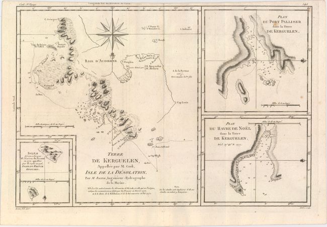
A. Terre de Kerguelen, Appellee par M. Cook, Isle de la Desolation [on sheet with] Plan du Port Palliser, dans la Terre de Kerguelen [and] Plan du Havre de Noel, dans la Terre de Kerguelen, by Rigobert Bonne, from Atlas Encyclopedique, circa 1787, (11.3 x 9.5"). This copper engraved map depicts the Kerguelen Islands in the Southern Indian Ocean. It shows the tracks of Captain James Cook who sheltered from a storm at Kerguelen on Christmas Day, 1776. The sheet also includes two additional charts, Plan du Port Palliser, dans la Terre de Kerguelen and Plan du Havre de Noel, dans la Terre de Kerguelen, as well as an inset at bottom left showing two islands discovered by Cook and Marion du Fresne. One of the few maps in the volume drawn by Bonne's son. Engraved by Andre. Condition: A nice impression with minor offsetting and a few faint spots.
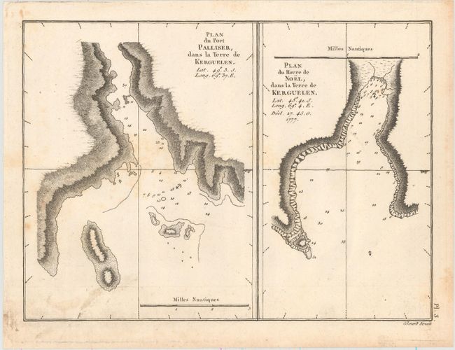
B. Plan du Port Palliser, dans la Terre de Kerguelen [on sheet with] Plan du Havre de Noel, dans la Terre de Kerguelen, by Cook/Benard, from Atlas du Troisieme Voyage de Cook, circa 1785 (8.9 x 6.5"). This sheet features two charts focusing on the Kerguelen Islands. The chart at left shows part of Rhodes Bay with nearby small islands. Christmas Harbor is featured at right. Both charts are oriented with the north to the right and include anchorages and soundings. Ref: Shirley (BL Atlases) G.COOK-4a #3.1 & 3.2. Condition: A dark impression with light scattered foxing and soiling.
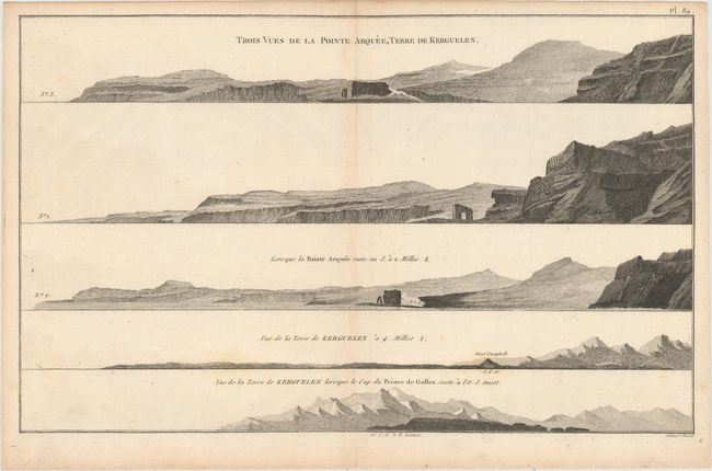
C. Trois Vues de la Pointe Arquee, Terre de Kerguelen, by Cook/Benard, circa 1785 (15.3 x 9.4"). This copper engraved view illustrates three landfall approach views of the Kerguelen Islands as surveyed by Captain Cook in 1777. Engraved by Robert Bernard after John Webber, one of the official artists who accompanied Cook on his third voyage. Condition: A crisp impression on watermarked paper with minor toning along the centerfold and a few faint spots.
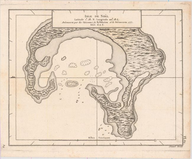
D. Isle de Noel, by Cook/Benard, from Atlas du Troisieme Voyage de Cook, circa 1785 (8.8 x 6.8").
The legend along the top border of this striking chart of Christmas Island indicates that the Resolution and Discovery came across the uninhabited island in 1777. Cook discovered the island on Dec. 24th and named it Christmas Island. He stayed until Jan. 1778. North is oriented to the left. Christmas Island is one of the Line Islands; now part of Kiribati, it is today called Kiritimati. Ref: Shirley (BL Atlases) G.COOK-4a #10. Condition: A sharp impression with a couple unobtrusive spots.
References: Shirley (BL Atlases) G.COOK-4a #2, #3, and #10.
Condition: B+
See description above.