Subject: North Pacific, Northeast Asia & Western North America
Period: 1758 (dated)
Publication:
Color: Black & White
Size:
13.8 x 10 inches
35.1 x 25.4 cm
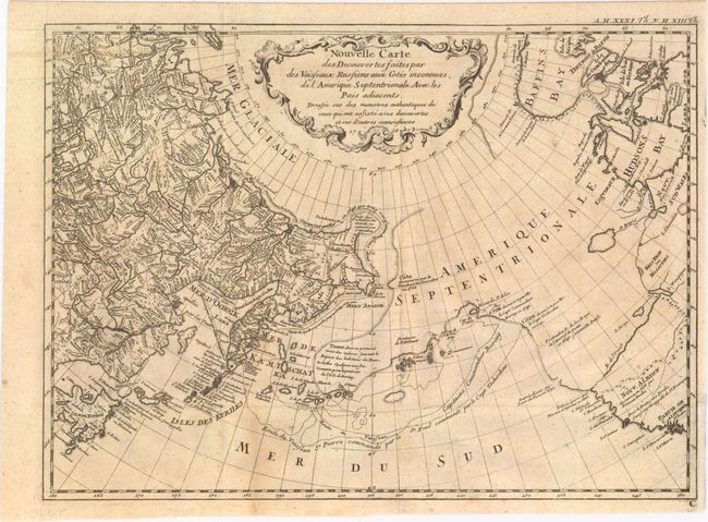
This is a rare, reduced-size version of Gerhard Muller's landmark map of 1754 showing the discoveries of Captains Bering and Tschirikow. Muller was a German scholar who worked for the Russian Imperial Academy of Sciences. He originally published his map in response to Joseph Delisle and Philippe Buache's map that showed previously unknown Russian discoveries and an elaborate (and entirely speculative) depiction of the imaginary voyage of Admiral De Fonte through a Northwest Passage. Muller's map shows an elongated landmass roughly in the shape of the Alaskan Peninsula and the Aleutian Islands. The speculative Northwest Passage is shown nearly connecting to Hudson Bay via a mythical River of the West. Muller's map was copied numerous times by different publishers due to increased interest in the region and the De Fonte controversy. This is a rare and fascinating addition to any collection of the Pacific Northwest.
References: Falk #1758-1, cf. Hayes, p. 29-32.
Condition: B+
Issued folding with light toning and a few faint spots.