Subject: Egypt
Period: 1652-54 (published)
Publication: Accuratissima Orbis Delineatio...
Color: Hand Color
Size:
19.8 x 14.8 inches
50.3 x 37.6 cm
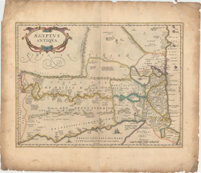
This lovely map is based on Ortelius' map of ancient Egypt with the cartographic sources of Diodor, Herodotos, Strabo, and Plinius. The map is oriented with north to the right and provides an excellent view of the Nile River valley. It is decorated with a large strapwork title cartouche and ships sailing in the Red Sea.
References: Van der Krogt (Vol. I) #8650H:1A.
Condition: B+
Original color on watermarked paper with light toning and soiling and minor scattered foxing. In the blank margins there are centerfold separations at top and bottom, several small worm holes, moderate soiling, and small chips and short edge tears along the edges of the sheet.