Subject: Madagascar
Period: 1858 (dated)
Publication: The London Atlas of Universal Geography
Color: Hand Color
Size:
19.1 x 25.3 inches
48.5 x 64.3 cm
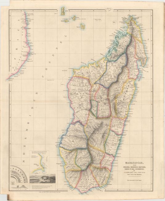
This rare topographical map of Madagascar is divided into regions. Only rivers, towns, and place names along the coast are identified, primarily confined to the eastern coast. At bottom left are three small insets depicting the Hova Fort at Tamatave (Toamasina) and a map showing the plan of attack on Toamasina by French forces on June 15th, 1845.
The map is based on "original drawings, sketches, diaries & oral information" from J.A. Lloyd, Surveyor General of the Maurituus. In a presentation Lloyd made to the Royal Geographic Society on December 10, 1849, which was subsequently published as Memoir in Madagascar by the Journal of the Royal Geographical Society of London, he states:
"Having but little further leisure, I have thought it better to submit at once the original and working map with all its faults. The coast line may be depended on as tolerably exact, having been reduced from the various nautical surveys; and many shoals, rocks, and rivers have been sketched in from detached charts and manuscripts which I have obtained a sight of. For the detail of the interior I cannot claim the slightest pretensions to correctness. It is only an attempt to form approximately some foundation for future inquiries, and more correct and extensive research."
References: Phillips (Atlases) #4339.
Condition: A
Original outline color with a hint of toning along centerfold and edges of sheet.