Subject: Southern Asia
Period: 1740 (circa)
Publication:
Color: Hand Color
Size:
22.6 x 19.7 inches
57.4 x 50 cm
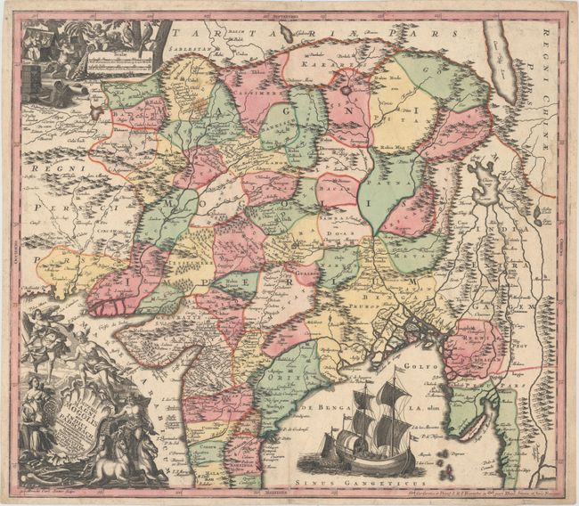
This is a superb map of the Mogul Empire, covering from Afghanistan through the Himalayas to Myanmar and including all of India except the extreme southern part. The map shows political boundaries, towns, rivers, and mountain ranges. The Chiam May Lacus is prominently depicted with five rivers flowing south. Beautifully engraved by Albrecht Karl Seutter, Matthaeus' son, this spectacular map illustrates eighteenth century German cartography at its zenith. The Bay of Bengal is completely filled with a vignette of a European trading vessel and a smaller landing craft. The allegorical title cartouche features Neptune, Mercury, Fame and Asia displaying her wealth and the distance scale is surrounded by putti digging through a treasure chest filled with ivory, jewels, silks and precious metals.
References:
Condition: B+
A dark impression with original color, a faint damp stain at right, and a small stain near the distance scale. A 1/2" centerfold separation and a 1/4" tear at bottom have both been closed on verso with archival tape.