Subject: Middle East
Period: 1720 (dated)
Publication: Atlas ou Recueil de Cartes Geographiques
Color: Hand Color
Size:
22.1 x 16.6 inches
56.1 x 42.2 cm
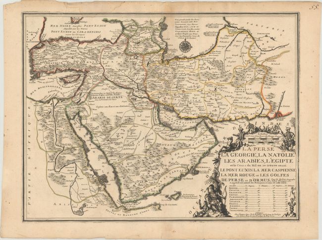
This detailed map of Persia, Anatolia, the Arabian Peninsula, and Egypt shows urban centers, towns, caravan stations, mountains, and even caravan routes, denoted by parallel lines. The full course of the Nile is shown from the source, les Yeux ou Sources du Nil in modern-day Ethiopia, to its mouth in the Mediterranean. Major water features such as rivers, lakes, seas, and gulfs are labeled as well. A table with the longitude and latitude for the most important locations are listed within the title cartouche. The large, decorative title cartouche features a camel, figures dressed in regional clothing, and an incense burner, all representative of the region.
References: Ankary #140; Pastoureau, FER II B.
Condition: B+
A dark impression with original outline color on watermarked paper. There is an extraneous crease at top right, minor soiling, a light damp stain at top, and a tear that just enters map border at top left that has been closed on verso with archival tape.