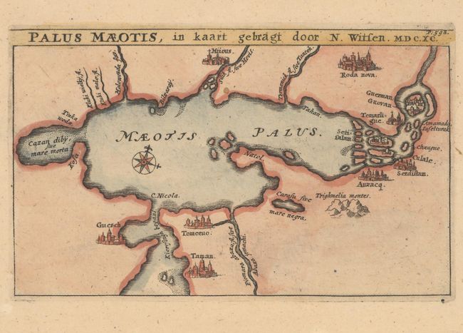
Subject: Sea of Azov
Period: 1690 (dated)
Publication: Noord en Oost Tartarye
Color: Hand Color
Size:
7.1 x 4.4 inches
18 x 11.2 cm
Nicolaas Witsen (1641-1717) was a Dutchman who was a cartographer, authority on shipbuilding, administrator of the VOC, and served as mayor of Amsterdam multiple times. Witsen traveled to Moscow in 1664-65, keeping a diary and collecting artifacts. He became fascinated about Russia and obtained all information available at the time on the subject, including maps, travelogues, manuscripts and objects. In 1692, Witsen published the most comprehensive and authoritative work on Russia and northern Asia, Noord en Oost Tartarye. A second expanded edition was published in 1705 with additional maps, and again reprinted in 1785. All editions are very rare.
This map depicts the Sea of Azov with several cities, rivers, islands, and a mountain identified. The city of Mariupol is in the north, with Kerch (Guerch) and Taman in the south along the Kerch Strait, connecting the Sea of Azov with the Black Sea. Several cities are depicted on islands in the east.
References:
Condition: A+
A clean and bright example on watermarked paper with minor soiling in the wide, blank margins.