Subject: Central Europe
Period: 1711 (circa)
Publication: Introductio in Universam Geographicam
Color: Hand Color
Size:
9.6 x 7.8 inches
24.4 x 19.8 cm
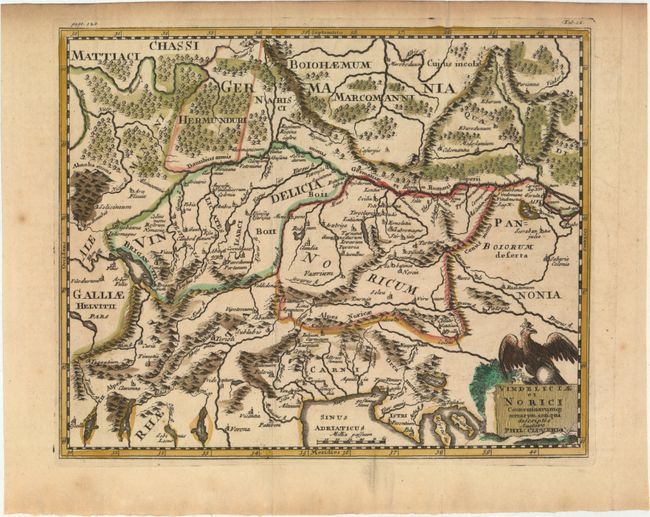
This historical map shows an important region of the old Roman Empire, covering parts of Germany, Austria, Switzerland, Hungary and Italy. It centers roughly on the important Danube River, which flows across the map. The title cartouche is surmounted by a royal eagle.
Cluver's Introductio in Universam Geographicam was a popular atlas, appearing in over 45 editions during a 100-year period. The first edition was published without maps in the 1620s, and the first edition to include maps was published circa 1641. The various editions were published in different cities throughout Europe, including Amsterdam, Nuremberg, and London. This map is from a London edition, with the majority of the maps re-engraved by John Senex.
References: Shirley (BL Atlases) T.CLUV-9a #14.
Condition: A
A crisp impression with attractive color, a hint of toning, and a damp stain along top edge of sheet, not affecting map. Issued folding.