Subject: Celestial
Period: 1835 (published)
Publication:
Color: Hand Color
Size:
14.5 x 16.3 inches
36.8 x 41.4 cm
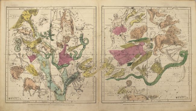
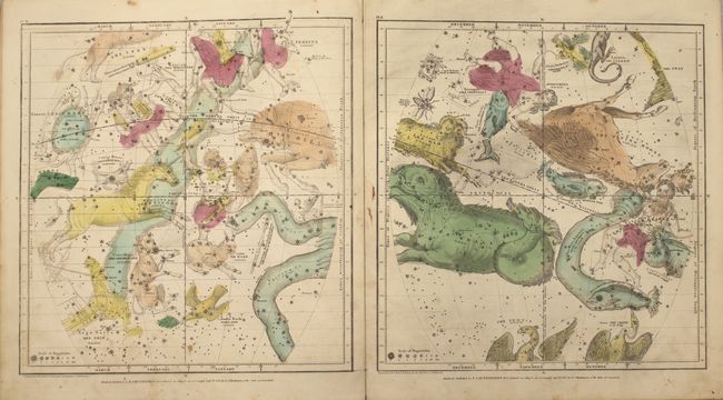
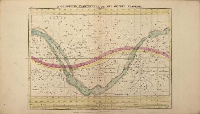
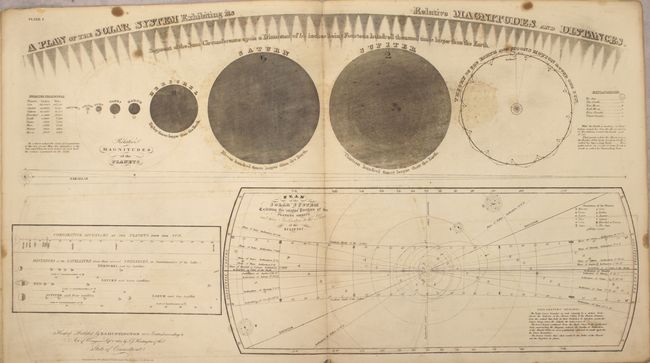
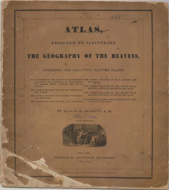
Complete celestial atlas with eight charts of the constellations. This popular star atlas was intended for the general public, rather than for professional astronomers. Only the brighter stars and nebulae, and their allegorical forms, are depicted on the charts. The stiff paper covers include a vignette of astronomers using a telescope. Charts include:
1) A Plan of the Solar System Exhibiting its Relative Magnitudes and Distances...
2) The Visible Heavens in January, February, and March.
3) The Visible Heavens in October, November, and December.
4) The Visible Heavens in April, May, and June.
5) The Visible Heavens in July, August, and September.
6) Southern Circumpolar Map for each Month in the Year.
7) Northern Circumpolar Map for each Month in the Year.
8) A Celestial Planisphere, or Map of the Heavens.
This example was previously owned by Pliny T. Sexton, an important lawyer and banker in Wayne County, New York in the late 19th century.
References:
Condition: B+
This atlas is nearly always found in poor condition, however in this example all but one of the charts are in B+ condition. The charts are generally clean and bright with original color and light soiling. The first chart is in lesser condition with light offsetting, several small stains, and a faint damp stain in the bottom portion of the image. The covers are heavily toned, chipped and soiled. A previous owner's name (Pliny T. Sexton) is stamped on the front cover.