Subject: Scandinavia
Period: 1711 (circa)
Publication: Introductio in Universam Geographicam
Color: Hand Color
Size:
9.8 x 7.9 inches
24.9 x 20.1 cm
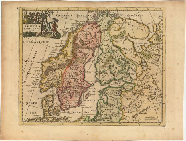
This handsome small map shows the historical regions in Scandinavia and the Baltic. The map is finely engraved to show the topography, forests and locates ancient cities. It is adorned with a decorative landscape cartouche featuring cherubs busily at work.
Cluver's Introductio in Universam Geographicam was a popular atlas, appearing in over 45 editions during a 100-year period. The first edition was published without maps in the 1620s, and the first edition to include maps was published circa 1641. The various editions were published in different cities throughout Europe, including Amsterdam, Nuremberg, and London. This map is from a London edition, with the majority of the maps re-engraved by John Senex.
References: Shirley (BL Atlases) T.CLUV-9a #31.
Condition: B+
Attractive color with light toning and scattered foxing primarily confined to the blank margins. Issued folding.