Catalog Archive
Auction 153, Lot 440

"L'Europe Dressee sur les Observations de Mrs. de l'Academie Royale des Sciences", Chiquet, Jacques
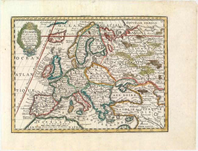
Subject: Europe

Period: 1719 (dated)

Publication: Le Nouveau et Curieux Atlas Geographique et Historique

Color: Hand Color

Size:
8.8 x 6.6 inches
22.4 x 16.8 cm
Download High Resolution Image
(or just click on image to launch the Zoom viewer)

This charming small map of Europe is based on the geography of Guillaume Delisle. The Prime Meridian is shown as the Ferro meridian that was established in the year 1634 by the French king Louis XIII and Cardinal Richelieu. This meridian was chosen because Ferro island is the most western position of the Old World.

References: Mickwitz & Miekkavaara #43-3.

Condition: A

A clean, bright example on watermarked paper with a couple of unobtrusive spots and several minute worm holes only visible when held to light.

Estimate: $160 - $190

Unsold

Closed on 5/20/2015

Archived