Subject: Europe
Period: 1705 (circa)
Publication:
Color: Hand Color
Size:
23.1 x 18.9 inches
58.7 x 48 cm
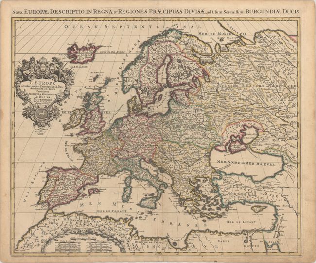
This map of Europe is divided into countries and provinces with good detail of towns and rivers throughout. The map extends to include Iceland. A decorative distance scale appears in northern Africa, and the title cartouche features Athena with a globe and cartographic instruments, a soldier with symbols of war, and the royal coat of arms of France. An alternate Latin title appears above the map: "Nova Europae Descriptio, in Regna & Regiones Praecipuas Divisae, ad Usum Serenissimi Burgundiae Ducis."
References:
Condition: B+
A nice impression with original color, light soiling, a professionally repaired centerfold separation at bottom, and a printer's crease adjacent to centerfold. There are two small worm holes along neatline at bottom.