Subject: Arctic Ocean, Barents Sea
Period: 1705 (circa)
Publication: Noord en Oost Tartarye
Color: Hand Color
Size:
6.9 x 5.2 inches
17.5 x 13.2 cm
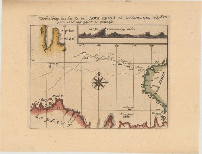
Nicolaas Witsen (1641-1717) was a Dutchman who was a cartographer, authority on shipbuilding, administrator of the VOC, and served as mayor of Amsterdam multiple times. Witsen traveled to Moscow in 1664-65, keeping a diary and collecting artifacts. He became fascinated about Russia and obtained all information available at the time on the subject, including maps, travelogues, manuscripts and objects. In 1692, Witsen published the most comprehensive and authoritative work on Russia and northern Asia, Noord en Oost Tartarye. A second expanded edition was published in 1705 with additional maps, and again reprinted in 1785. All editions are very rare.
This map depicts the ice pack between Spitsbergen and Novaya Zemlya that was seen in the year 1676. A ship's route is shown with a dotted line in the Barents Sea, with a line of ice shown to the north. An inset at top right illustrates a coastal approach view of the ice with its numerous peaks. Partial coastlines of Spitsbergen, Novaya Zemlya and northern Norway are shown. The map is based on the account of Captain Wood's voyage to Novaya Zemlya in search of a Northeast Passage through the Arctic Ocean.
References:
Condition: A
A clean, bright example on watermarked paper with marginal soiling.