Subject: North Atlantic
Period: 1794 (dated)
Publication: A New and Elegant Imperial Sheet Atlas ... of the World...
Color: Hand Color
Size:
40.9 x 27.9 inches
103.9 x 70.9 cm
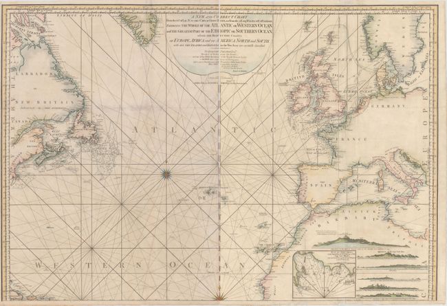
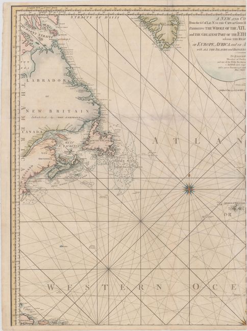
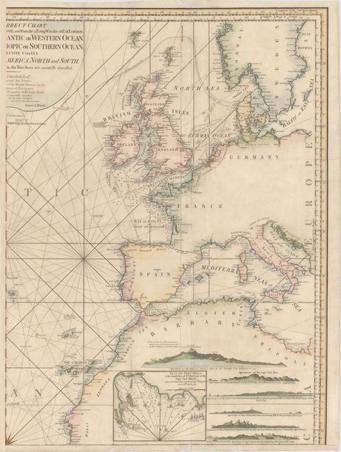
These are the two northern sheets of a huge four-sheet map of the Atlantic Ocean. The western sheet includes the southern tip of Greenland, eastern Canada from the Hudson Strait south to Cape Cod, and as far south as Hispaniola and Puerto Rico. The eastern sheet includes most of Europe and northwestern Africa, as far south as Arguin Bay. Detail is confined to the coastlines, with numerous place names, anchorages, soundings, and other navigational detail. The fishing banks surrounding Newfoundland are well depicted, however the coasts surrounding Hudson Strait are still conjectural. Within Africa are 6 land approach views and an inset depicting the French attack from April 18, 1781 on Port Praia, located at the southern end of Santiago in the Cape Verde Islands. Measurement is for the two sheets combined.
References:
Condition: B+
A nice impression with attractive color and light soiling. There are several fold separations that have been archivally repaired, and there is minor loss due to a small abrasion along the southern coast of Ireland, with a minor amount of image replaced in facsimile.