Catalog Archive
Auction 153, Lot 413

"A Chart of the Coast of Guayana, from the Entrance of the River Orinoco...", Mount & Page

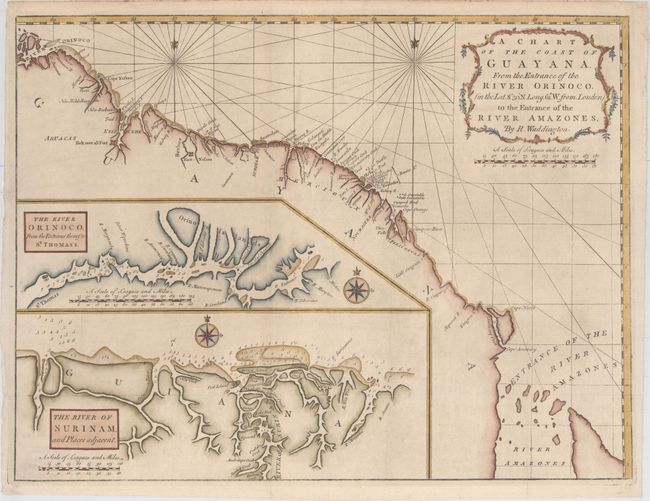
Subject: Guyana, Suriname, French Guiana

Period: 1773 (circa)

Publication: The English Pilot

Color: Hand Color

Size:
24.3 x 18.4 inches
61.7 x 46.7 cm
Download High Resolution Image
(or just click on image to launch the Zoom viewer)

This navigational chart depicts the coastline from the Orinoco to the Amazon Rivers, with many small islands, navigational hazards, and two forts noted (Kick over all Fort and Fort Nassau). Two large insets show the entrances to the Orinoco and Suriname Rivers in great detail, with numerous soundings. The map is attributed to Robert Waddington.

References: Sellers & Van Ee #2145.

Condition: A

Issued folding, now pressed with good margins. There are a few minor extraneous creases.

Estimate: $230 - $275

Sold for: $160

Closed on 5/20/2015

Archived