Catalog Archive
Auction 153, Lot 403

"Nouvelle Carte Illustre de l'Amerique du Sud Indiquant les Grandes Divisions Physiques, la Distribution Geographique des Vegetaux et des Mineraux...", Vuillemin, Alexander A.

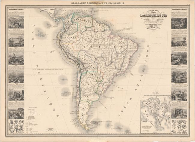
Subject: South America

Period: 1860 (dated)

Publication: Geographie Commerciale et Industrielle

Color: Hand Color

Size:
33.2 x 23.6 inches
84.3 x 59.9 cm
Download High Resolution Image
(or just click on image to launch the Zoom viewer)

This magnificent large chart is from this scarce nineteenth century atlas. The map is filled with an impressive array of information illustrating the physical and geographical divisions, colonial possessions, roads and railways, forts, mines and the plant and mineral distributions. Includes an inset of the Western Hemisphere showing the primary shipping routes. The map is flanked with side panels containing numerous meticulously engraved vignettes representing the various industries and peoples of the different countries and regions.

References:

Condition: B+

Original outline color with short, archivally repaired centerfold separations at top and bottom. There are a couple of light spots in the map and some damp stains in the blank margins, but it is overall very clean and attractive. There are some tiny tears in the blank margins, not affecting the map.

Estimate: $350 - $425

Sold for: $210

Closed on 5/20/2015

Archived