Catalog Archive
Auction 153, Lot 386

"Geographical, Statistical, and Historical Map of Cuba and the Bahama Islands", Carey & Lea

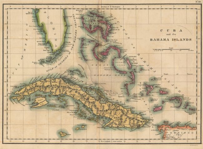
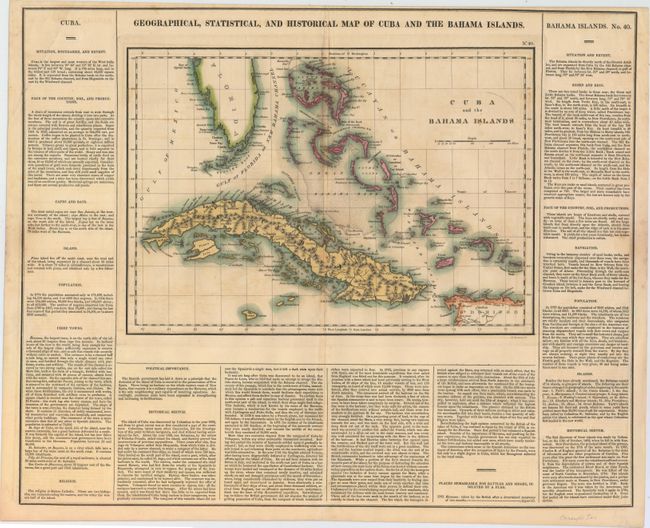
Subject: Cuba & Bahamas

Period: 1822 (circa)

Publication: American Atlas

Color: Hand Color

Size:
13.7 x 9.6 inches
34.8 x 24.4 cm
Download High Resolution Image
(or just click on image to launch the Zoom viewer)

This chart extends from the southern tip of Florida through the Bahamas and Cuba. Also shows Grand Cayman and part of St. Domingo. The Bahamas Island group are particularly well shown. The chart is surrounded by text detailing the history and other information on the region. On a full sheet with text measuring 21.6 x 17.3".

References:

Condition: B+

Original color with light toning along the centerfold and two short centerfold separations that have been closed on verso with archival tape.

Estimate: $230 - $275

Sold for: $170

Closed on 5/20/2015

Archived