Catalog Archive
Auction 153, Lot 384

"Isla de Puerto-Rico", Alabern, Ramon

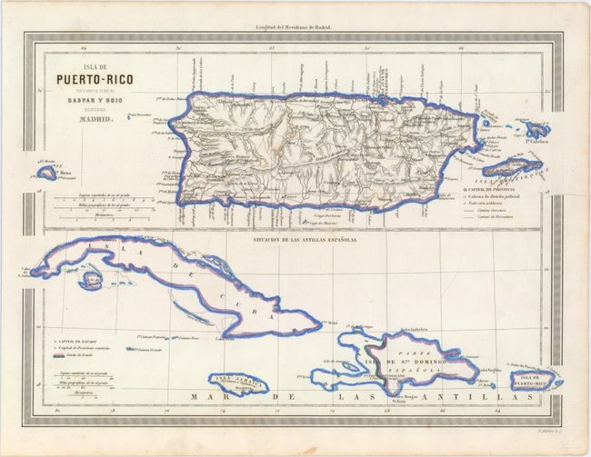
Subject: Greater Antilles

Period: 1864 (circa)

Publication: Atlas Geografico de Espana

Color: Hand Color

Size:
11.7 x 8.4 inches
29.7 x 21.3 cm
Download High Resolution Image
(or just click on image to launch the Zoom viewer)

This uncommon Spanish map depicts the Greater Antilles. The upper portion of the sheet presents a detailed view of the islands of Puerto Rico, Vieques and Isla de Culebra showing towns, cities, roads, rivers and topography. The lower portion shows a simplified view of political boundaries with a color-coded key identifying the areas under Spanish control. Published by Martin Ferreiro in the Atlas Geografico de Espana.

References: Phillips (Atlases) #5287 [56].

Condition: A

An attractive example with just a few faint spots of foxing.

Estimate: $220 - $250

Sold for: $150

Closed on 5/20/2015

Archived