Catalog Archive
Auction 153, Lot 374

De Fer's Scarce Map of the Gulf of Mexico with Florida as a Peninsula

"Le Golfe de Mexique, et les Provinces et Isles qui l'Environe Comme sont la Floride au Nord, le Mexique ou Nouvelle Espagne...", Fer, Nicolas de

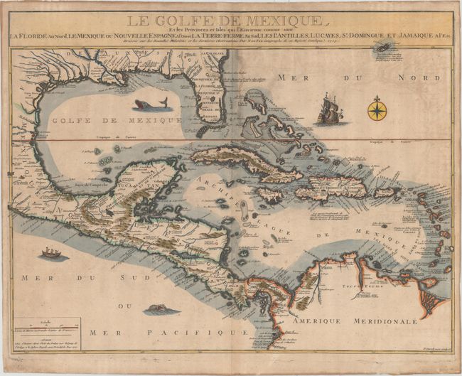
Subject: Gulf of Mexico & Caribbean

Period: 1717 (dated)

Publication:

Color: Hand Color

Size:
23.8 x 18.2 inches
60.5 x 46.2 cm
Download High Resolution Image
(or just click on image to launch the Zoom viewer)

This is scarce map of the Gulf of Mexico and the Caribbean. Unlike most maps of the period, De Fer presents Florida correctly as a peninsula rather than as the broken archipelago. Lake Okeechobee is named Lac Serrope. The Caribbean islands are also well depicted with numerous notations throughout. The map is filled with place names and graphic topography. Embellished with a compass rose, large galleon, canoe with three natives, and two sea monsters. Engraved by P. Stark.

References: Lowery #281.

Condition: B+

A nice impression on watermarked paper with light toning and offsetting primarily at top right. There is moderate toning along the edges of the sheet, along with some tiny chips and tears.

Estimate: $1,600 - $1,900

Unsold

Closed on 5/20/2015

Archived