Subject: Pennsylvania, Geology
Period: 1885 (published)
Publication:
Color: Printed Color
Size:
6 x 9 inches
15.2 x 22.9 cm
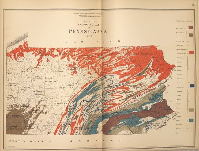
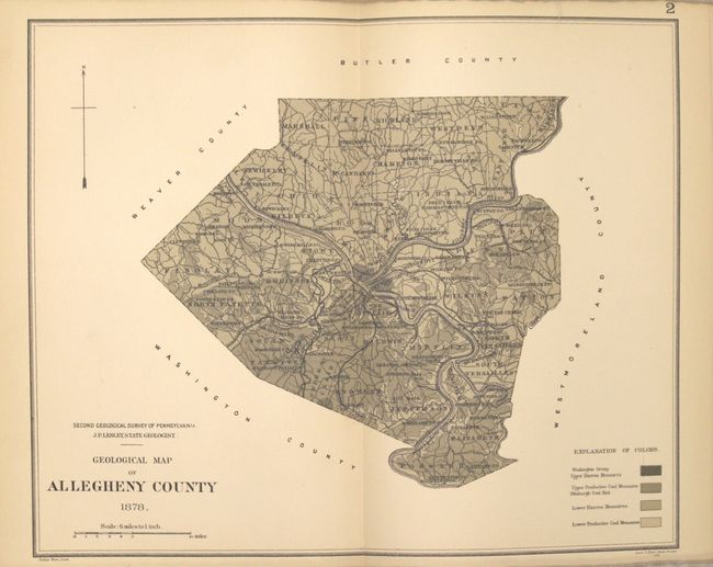
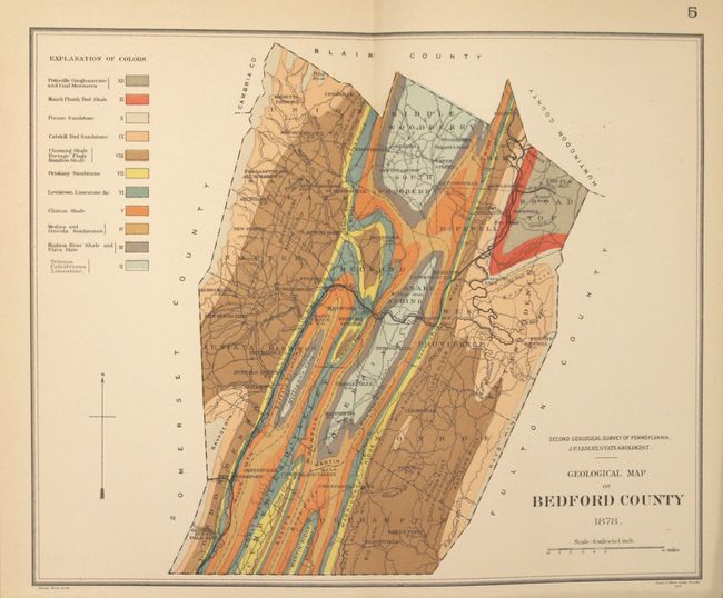
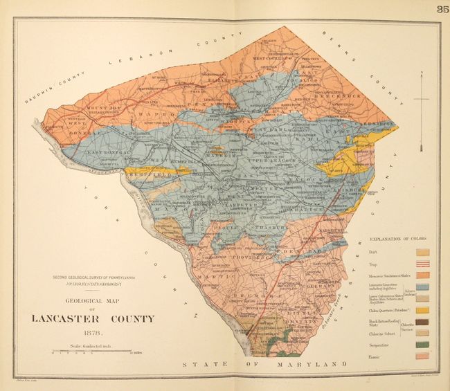
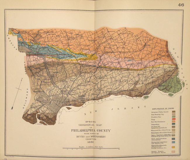
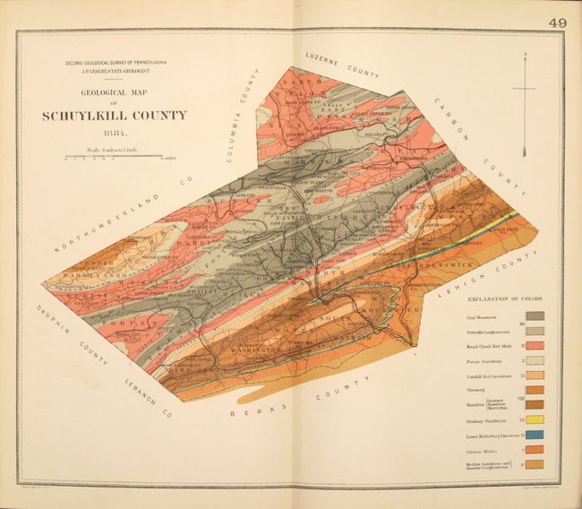
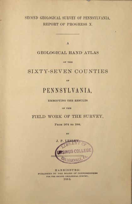
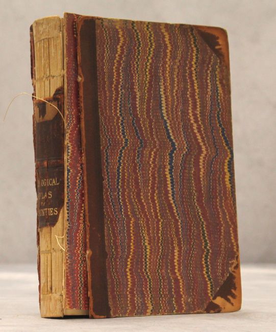
The Second Geological Survey of Pennsylvania began after the Civil War and was overseen by J. P. Lesley, who became state geologist in 1875 and served in that capacity until 1889. This octavo volume focused on county maps, published in 1885, contains 62 double-page colored maps including 61counties and 1 map of Pennsylvania. In addition to the maps is 112 pp. of text which describe the progress of the surveying efforts and provides short accounts of the geologic features of each county. Maps are dated between 1878-1884. Hardbound in quarter leather and tips over marbled boards with gilt title on spine.
References:
Condition: B+
Condition code is for the maps which are generally very good to near fine with faint toning along sheet edges and occasional light color offsetting. The Berks County map also has fold separations at top and bottom that enter the image. There is a library stamp on the title page and a bookplate on the inside front cover marked "withdrawn." Covers are present but detached and the spine has perished.