Subject: New York
Period: 1878 (published)
Publication:
Color: Hand Color
Size:
5.5 x 105 inches
14 x 266.7 cm
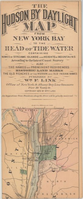
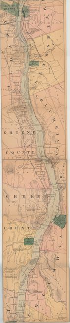
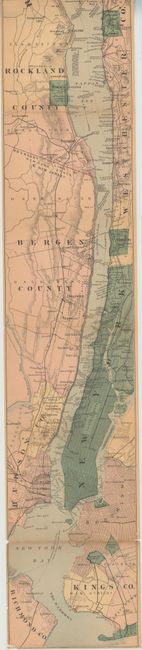
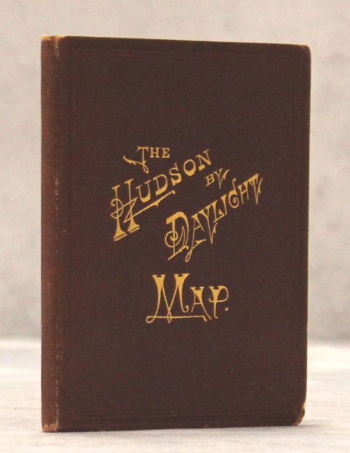
A remarkable map in strip-chart format that is over 100 inches long! Includes amazing detail on the map that is drawn on a scale of 1.5 miles per inch. Complied from U.S. Coast Survey data, this extraordinary map includes the names of prominent residences along the Hudson, historical landmarks and Indian names. Includes 32 pp. of descriptive text and numerous advertisements. Folds into maroon cloth wrappers with title page "The Hudson by Daylight. Map Showing the Prominent Residences, Historic Landmarks, Old Reaches of the Hudson, Indian Names, &c., with Descriptive Pages."
References:
Condition: B+
The map is lightly toned with a few fold separations that have been mostly closed on verso with archival tape. Narrow left margin as issued and no top margin, which is adhered to the text and the map image is now separated. Text is detached from covers, which are in very good condition.