Subject: New Mexico
Period: 1898-1901 (circa)
Publication:
Color: Printed Color
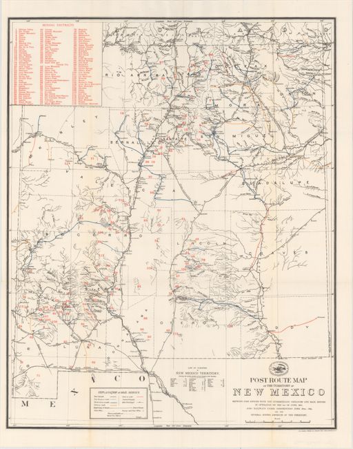
A. Post Route Map of the Territory of New Mexico Showing Post Offices with the Intermediate Distances and Mail Routes..., by The Norris Peters Co., circa 1901 (17.1 x 21.1"). Very interesting and detailed map of the territory showing the post offices and mail routes in operation. The routes are shown with different colors to depict the frequency of service, from once a week to six times a week. The map also details the railways under construction. A table in the upper corner names 116 mining districts that are numbered and located throughout the map. Above the title, the logo of the Post Office Department shows a pony express rider and a train. Printed by The Norris Peteres Co., Photo-Litho. Condition: A clean and bright example, issued folding with a hint of toning along one fold.
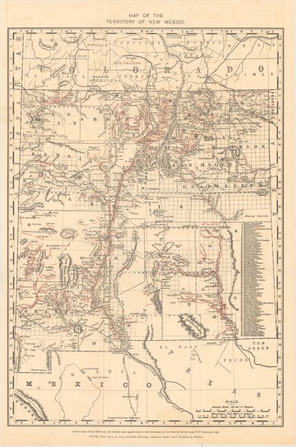
B. Map of the Territory of New Mexico, by General Land Office, circa 1898 (13.1 x 18.8"). A table at right names 80 mining districts that are numbered and located throughout the map. Eighteen counties are delineated with red overprinting on the map indicating springs, running water, and irrigation ditches. Condition: An attractive example with a few tiny spots and an edge tear at left that extends 1.5" into the image closed on verso with archival tape.
References:
Condition: A
See description above.